
24/7 observation with logging
Take-off / landing fee payment
Take-off / landing fee payment

Event LoggingAI based event detection with pre-defined zones
|

Movement & PositionMovement & GPS logging with time stamp
|

PaymentsProvision of aerodrome payment function
|
A great product & great partners:

|

|

|

|
|
|

|
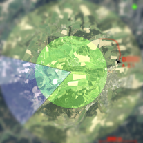
The system detects objects (aircraft, vehicles and persons) that are within the cameras observed area. It classifies different object categories and shows the detection in the camera image and on the map. Further the object position is calculated, providing a GPS location with actual timestamp. Data privacy is respected by pixelate person detections. |
|

All aircrafts that are equipped with an activate ADSB or FLARM system are detected within the airport area. The actual aircrafts position, its latest flight path and altitude are illustrated on the airfield map. The data is used to document take-offs and landings and can be replayed in case needed. |
|

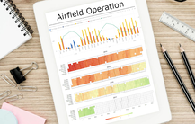
The data collected by the system over the past 12 months is used to generate regular operational reports. For all aircrafts registered at the airport, the flight time is recorded with UTC times. In addition, all other external aircraft that have landed at the airfield are documented with the registered number plate and the assigned date and UTC time. This function supports the airfield operations monitoring around the clock. In addition, the report completes the local airfield activities taking into account visually recognized and classified objects. |
|


|
|
The system operates 24/7 and its operation mode is changed automatically considering current geo referenced civil twilight. The operation mode can be changed from "Normal Operation" (airfield is in normal operation), to "Airfield Closed" (in example after civil twilight to surveil the airport in protected mode) up to "System Off" (turing the system off).
The system architecture is a mix of cloud based and local computing processes. This allows the operator in charge to access the system information via computer or mobile devices. The system operates at all weather conditions.
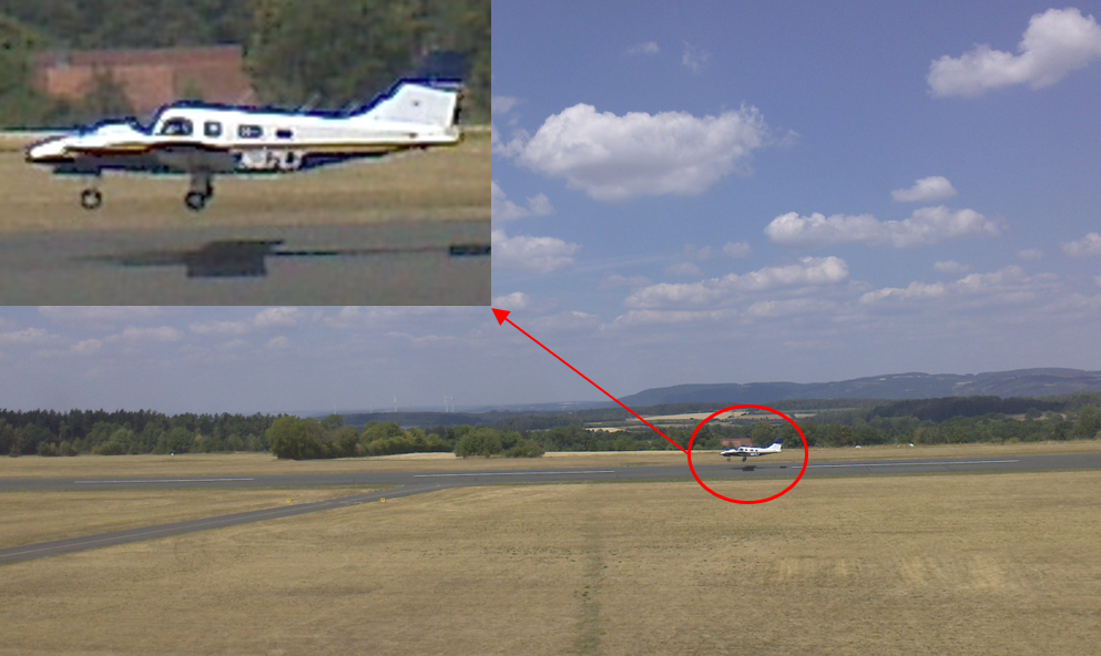
Our system uses high quality professional surveillance cameras that record in addition high-resolution images. These images are dated with timestamp information and can be called up with our help in urgent situations. This can help to clarify safety-critical situations. The recording function of single images can be stopped by the responsible operator in an emergency. |
|


|
|
Our payment solution is offered together with a strong partner. The payment is easy accessible to pilots by QR codes at the aerodrome. This improves payment efficiency, keeps flexibility and ensures 24/7 payment option. The payment information is logged for the airfield operator in our connectivity app and the payment is done directly to the local aerodrome.
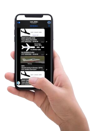
The system provides in real-time messages to the mobile phone of the aerodrome responsible. Information about approaching and departing aircrafts are provided, as well as take-offs and landings are documented.
|
|

|
|